Remote Sensing Material: Components, Functions (Complete)
Loading...
In the field of geography, remote sensing is a very important science and must be mastered to everyone who wants to become an expert in the field of geography, including the components of remote sensing alone.
Remote sensing is very synonymous with the use of maps and map scales.
By using remote sensing, humans can find out various information related to a particular object without having to do surveys and studies in that area first.
For more information regarding remote sensing components, take a good look at the reviews below!
list of contents
Definition of Remote Sensing
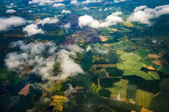
Remote sensing is an acquisition or measurement of data on an object or phenomenon by using a device that is not physically in contact with the object or remotely.
Examples are from planes, satellites, spacecraft, and ships.
If simplified, remote sensing can also be defined as a development of shooting technology that is done in the air.
It is called so because with this technology, shooting activities are carried out in the air.
As well as being done remotely, it can be taken from inside the fuselage, satellite, spacecraft, or something else.
This technology will also continue to develop and then be used in various fields.
If in the early days of its discovery it was only used in photographing the state of the earth from outer space. So there is a modern era like now being able to use more sophisticated and complex devices.
For example, to photograph the state of health of the human body or known as medical sensing.
Certain medical equipment is required to be able to photograph the state of the human body from the inside.
So that the medical team can find out how the patient's condition and the progress of the disease.
Remote sensing technology can also be used for weather observations.
Where later by the Meteorology Agency, for example, this technology can be used to determine weather changes and forecast weather
Understanding Remote Sensing According to Experts

In addition to the above understanding, there are also several definitions of remote sensing that are spoken by experts, including:
1. American Society of Photogrammetry
Remote sensing is a measurement or information collection of various properties of objects and phenomena by using a recording device that is not physically in direct contact with objects or phenomena studied.
Thus, this (remote) sensing technology even produces photos or shots, but the equipment to obtain the photo is not directly handled by humans.
This one tool is operated using a computer-based system. So that the operator just directs the movement and determines the time when to aim at the object.
2. Lillesand and Kiefer
Remote sensing is a science and art to obtain information related to areas, objects, or phenomena with how to analyze the data obtained using a tool without direct contact with the area, object, or phenomenon being studied.
3. Welson and Bufon
Remote sensing is an art, science, and technique for detecting areas, objects, and phenomena using tools and without direct contact with these areas, objects or phenomena.
4. Aver
Remote sensing is an attempt to obtain, indicate (identify), and analyze objects by using sensors in the observation position of the study area.
5. Colwell
Remote sensing is a measurement or acquisition of data on objects on the earth's surface from satellites or other instruments above or far from the object being sensed.
6. Curran
Remote sensing is the use of electromagnetic radiation sensors with the aim of recording images of the earth's environment that can be interpreted so that it will produce useful information beneficial.
7. Campbell
Remote sensing is a science to obtain information related to the earth's surface, such as land and water, from images obtained from a distance.
8. Lindgren
Remote sensing is a variety of techniques developed for the acquisition and analysis of earth-related information.
Through a series of opinions related to the definition of remote sensing above, it can be concluded that remote sensing is a a technology that is also used throughout science in order to be able to obtain analysis of information related to the earth and taken from a great distance far.
Remote Sensing Concept
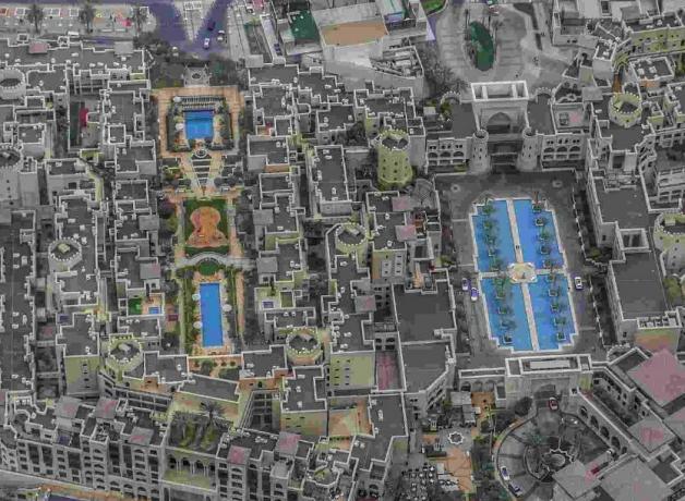
Remote sensing is also referred to as a system, because its use involves several interconnected components.
These various components consist of power sources, sensors, atmosphere, interaction of energy with objects, data acquisition, and data usage.
These components work together in order to obtain a photo as a result of sensing.
When a component is missing, the remote sensing process cannot be carried out. That's because it can eliminate other components. Especially the components of data acquisition and data usage.
How can data be obtained if the tool does not support it? So, how can this data produce photos that can be used for a purpose?
The answer:
All the components that have been mentioned must be present at the same time support the performance of the remote sensing device.
Regarding remote sensing, it is strongly influenced by sunlight which is the main source. So this one technology was then developed, so that it has two different types of remote sensing, namely:
1. Passive Remote Sensing
Passive remote sensing uses the sun as the main energy and works together with all the components in remote sensing.
The energy source can be in the form of emissions, sunlight, the temperature of objects on the earth's surface (objects), or others.
2. Remote Sensing Active
Active remote sensing is sensing where the power comes from artificial power.
For example pulses on radar, rays from lights, or something else.
Remote Sensing Components
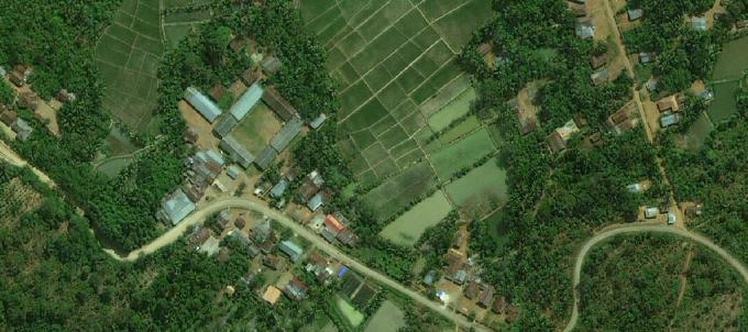
The following are some of the factors that affect remote sensing or also known as remote sensing components, including:
1. Power Source
The power source here is defined as a tool used in photographing that requires a power source to be able to carry out its functions.
In this one energy source, it can be in the form of sunlight which will produce temperature.
The increase in temperature will then be absorbed by certain parts of the tool to be converted into energy.
So that the tool for photographing needs to accommodate more sunlight during the day.
To be able to operate or function within 24 hours, be it during the day or night.
2. Atmosphere
The next component is the atmosphere which can affect the ability of the tool when working on remote sensing in order to carry out its functions.
Because the state of the atmosphere can determine how much and how much energy source can be absorbed by the tool.
If the weather is cloudy and cloudy, it can reduce the amount of energy sources that will be absorbed by the tool.
Likewise if there are other disturbances in the atmosphere.
So this can happen because the atmosphere contains a number of molecules such as carbon dioxide (CO2), oxygen (O2), hydrogen, nitrogen, and others.
These molecules can reflect, absorb, and pass through electromagnetic radiation.
So that it will greatly affect the performance of the tool so that it can take pictures from the air.
3. Interaction Between Force and Object
Each object to be photographed produces a different photo.
In general, it will be influenced by the state or character of the object itself.
Objects that have low reflectivity in the power source will produce a darker photo, and vice versa.
So that when the tool is used in photographing mountains whose peaks are covered by snow, it will produce bright photos because snow has a high reflecting power.
And vice versa.
When used to photograph mountains with lava-covered peaks, the results will be darker, because lava has a low reflectivity.
4. Sensors and Rides
Sensors function to detect the presence of objects and determine their location and play a role in determining the distance between the tool and the object.
Or in determining how close the photo can be taken from the tool to the object.
This sensor is a special tool that is installed on the vehicle.
So that when it detects an object it will show a sign.
The vehicle is a place for photo equipment to be installed, which can be on satellites, planes, or others.
5. Data Acquisition
As the name implies, this one component will show data obtained from tools that have found objects and are detected by sensors installed in the tool.
The data obtained is the result of reflection between the power source and the object.
There are generally two types of data obtained, namely:
- Can be obtained manually through the image interpretation process.
- And numerical data obtained through the use of special software embedded in a computer.
6. Data Usage
This one component will lead to the process of using data obtained from the use of sensing devices.
That is, it can be in the form of a photo, where the photo is then used for various needs.
The process of using this data will later become the final component of the sensing technology.
This final process will be very important because it determines whether there are benefits to be obtained from the data obtained.
If it is not used, then there is no benefit, and vice versa.
Remote Sensing Process
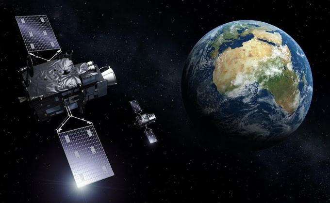
The remote sensing process begins with the energy source coming from the sun and then turns into electromagnetic waves and is directed to the target source.
This sun will also help in focusing targets on earth.
The wave will be reflected again after contact with a target on earth.
The reflected waves are then received by sensors to be recorded on the satellite.
The recording results obtained by the next recording sensor will be forwarded to the receiving station and processed into a digital image or image hardcopy.
Advertisement
Then the image is analyzed visually to obtain information from the target source.
From these results can obtain information to help solve a problem.
In simple terms, the remote sensing process is divided into several stages, including:
1. Detection
It is a useful early stage to detect anything obtained and related to the research.
This includes taking photos using modern tools.
2. Identification
The next step is to identify the results that have been obtained from remote sensing.
Performed calculations, matching using formulas into an important stage to obtain information.
3. Analysis
Is the last way of the remote sensing process, which is to detect all the results that have been obtained.
In this first stage, analysis is carried out based on reference sources and more in-depth literature when viewed from a scientific point of view.
In the remote sensing process, it will produce output which is called an image.
The image is divided into 2 types, namely:
A. Photo Image
An image of the object from the results of photographing the air which generally uses an airplane.
Photo images are divided into:
1. Based on Electromagnetic Spectrum
a. Ultraviolet Photo
Photos are printed using the ultraviolet wave spectrum which has a wavelength of 0.29 micrometers.
Its function is to distinguish 2 kinds of substances.
b. Orthochromatic Photo
Photos printed using the visible spectrum of the blue to some green.
Wavelength 0.4 – 0.56 micrometers.
This photo can see objects below sea level and is suitable for coastal areas.
c. Panchromatic Photo
Photos using the visible light spectrum so that the results are the same as the sensitivity of the eye.
Panchromatic is divided into black and white panchromatic (the printout is the same as the original color) and infrared photo (using infrared waves and used for agriculture, military, and plantation).
2. By Camera Axis Direction
- Tilted photos, photos taken at an angle of at least 10 degrees.
- Upright photos, photos taken perpendicular to the earth's surface.
3. By Camera Used
- Single photo, photo taken using a single camera.
- Multiple photos, more than one photo taken at the same time and location.
4. By Color
- False color photos, have different colors from the original color.
- Real color photos, have the same color as the original object.
5. Based on the Rides Used
- Aerial photos, obtained from planes and hot air balloons.
- Satellite photos, obtained from satellites.
B. Non-Imagery Photos
Non-image photos taken using sensors built into the satellite.
1. Based on Electromagnetic Spectrum
- Radar and microwave images
- Thermal infrared image
2. Based on the Sensor Used
- Multispectral image
- Single image
3. By Rides
- Aerospace imagery, created with a vehicle that is in the air.
- Satellite image, made by the space agency. For example, weather sensing satellite imagery, planetary sensing satellite imagery, ocean sensing satellite imagery, and earth resource sensing satellite imagery.
Remote Sensing Image Type

Image is also defined as a recording image of an object (generally in the form of an image on a photo produced by optical, optical, mechanical, electro-optical or electronic means).
Image elements in remote sensing include:
1. Size
Size is an object recognition in the form of volume, distance, description and height.
Do in remote sensing photos, this one size is also referred to as scale.
So the photo obtained is the smallest size version of the actual size.
So in order to provide clarity, the size is included in the scale. So that when reading a map or atlas there is the term scale.
Because photos of the state of the earth's surface show a small size from the original appearance.
2. Hue or Color
Hue or color is a level of brightness of objects in the image. Starting from very dark colors to very bright.
In panchromatic photos, in general, the colors that appear are what the eye sees.
The presence of these colors will create photos with remote sensing technology that are more lively or natural.
3. Pattern
Pattern is a spatial arrangement of various macro image elements in aerial photography.
In this pattern will show a picture of the object being targeted.
In the photo of the earth, the pattern will be shown from the work of humans on the earth's surface.
For example in cultivating fields, rice fields, rivers, plantations, swamps, and others.
4. Form
A shape is a configuration of an object when viewed from above.
This definition is in accordance with remote sensing technology which is a technique for photographing from the air as well as from a distance.
Then there is the term object configuration when viewed from above and is called the word "form".
5. Shadow
The next image is a shadow.
Shadows are an identifying element in the interpretation of aerial photographs. There are so many objects that are difficult to recognize according to their actual form but by looking at the shadows sometimes it will be easier to observe.
6. Texture
Texture is a frequency of arrangement and change in hue of a group of objects that are not distinguished individually because they have a very small size.
From the texture is also described qualitatively as coarse, medium and fine.
7. Association
Association is a relationship of one object with another object in remote sensing photos.
For example, there are photos showing mountains with rice fields and rivers around them.
8. Site
Site is a location of objects in relation to other objects, can be very helpful for object recognition of an object.
So from the photo the results can be known the location of a pattern.
For example, rice fields in the highlands, rivers in lowlands, or others.
Benefits of Remote Sensing

The following are some of the benefits of remote sensing that you need to know, including:
1. Knowing All Objects in One Place
Sensing can help to find out what objects are in a place.
Examples such as mountains, rice fields, waterfalls, rivers, seas, and other appearances of the earth's surface.
This can be used to design appropriate and appropriate regional development.
2. Help Knowing the State of a Place Exactly
Remote sensing can provide a valid and relevant picture of a place situation.
So that it can be used to find out what kind of road conditions a place has, what it looks like, or so on as long as it is on the face of the earth.
3. Documenting the Change of a Place
Remote sensing can be done on a regular basis, made per week, per month, to per year.
This can help to know the changes or developments of a place over time.
Is it in line with expectations or vice versa.
4. Time, Energy and Cost Efficiency
If you go directly to the field to find out the condition of a place, check the terrain, and others. Then it will take a long time as well as require a lot of energy and cost.
But by using this sensing it can be suppressed so that it will give efficiency to these three aspects.
5. Helping Disaster Management
The next benefit is that it can be used to deal with disaster problems, especially natural disasters.
So that by using the results of remote sensing photos, the state of an area affected by a disaster can be known.
When the SAR team is working on the rescue, they can learn about his condition from the photos.
Knowing which path is safe, which location is closest to the victim, or something else.
Advantages, Limitations and Disadvantages
The following are some of the advantages, limitations, and disadvantages of remote sensing, including:
1. Superiority
According to Sutanto (1994:18-23), the use of remote sensing, whether measured by the number of fields of use or from the frequency of use in each field, has increased rapidly.
This is due to several factors.
- The image shows areas, objects, and symptoms on the earth's surface with the shape and location of the object resembles the shape and location on the earth's surface, is relatively complete, covers a large area, and is permanent.
- From certain types of images, a three-dimensional image can be generated if the observations are carried out using a tool called a stereoscope.
- Characteristics of objects that are not visible can be realized in the form of images so that object recognition is possible.
- Images can be created quickly even for areas that are difficult to explore on a terrestrial basis.
- Imagery is the only way to map disaster areas.
- Images are often created with a short return period.
2. Limitations
In the form of the availability of SLAR images that are not as much as the availability of other images.
Even from existing images, not much is known and used (Lillesand and Kiefer, 1979).
In addition, the price is also relatively expensive compared to other image procurement (Curran, 1985).
3. Deficiency
Although it has many advantages, remote sensing also has some disadvantages such as:
- The equipment used is expensive.
- People who use it must have special skills.
- It is difficult to obtain both photo and non-photo images.
Remote Sensing Example

After knowing the various information related to remote sensing above, here are examples of easy-to-find sensing, including:
1. River
This river is identical to having a dark hue on a clear river with an elongated shape with an erratic direction and widening towards the sea.
For its smooth and uniform texture, and associated with burnt.
2. Highway
Because it has the characteristics of the interpretation of the highway in the image in the form of a brighter hue than the surrounding object.
As for the shape itself, it is elongated, with a pattern of almost uniform width, smooth texture, and there are intersecting parts that are perpendicular to and associated with the bridge.
3. Settlement
Occupied settlements that always have a characteristic medium white to gray color.
The texture itself is relatively rough, in the form of boxes that are close to each other or spread out, and are associated with the road.
4. School Building
Images related to school buildings have inherent characteristics with bright colors, shaped like the letters I, L, or U.
Has a size that is large enough than other objects around it, smooth texture, and is associated with a large yard/sports field.
5. Plantation
Examples of image forms related to Palm Oil which are identical with rough textures, regular and lined patterns, and the shape of the crown like a tight star.
6. Football field
In the arena related to remote sensing results, one is easy to find, namely the Sports Field with Its trademark has a bright color, rectangular shape, smooth texture, and is associated with existence goal.
X CLOSE
Advertisements
X CLOSE
Advertisements
