Understanding Map According to Experts, Purpose, and Functions
Loading...
The definition of a map is a picture of the earth's surface that is displayed in a flat area using a certain scale.
For the presentation itself also exists in various ways. Starting from conventional printed maps to digital maps.
The term of the word map itself comes from the Greek "mappa" which means table cloth or cloth.
A map is also a two-dimensional representation of a three-dimensional space.
The study of making maps themselves is called cartography.
Many maps have a scale, which determines how large objects on the map are and their actual conditions.
These various collections of maps are known as atlases.
There are several other meanings of maps mentioned by experts. For more information, see carefully the reviews below.
list of contents
Understanding Maps According to Experts

The following are some definitions of maps according to experts that you need to know, including:
1. International Cartographic Association (ICA)
A map is a scaled image in a flat medium.
Has a real and abstract appearance that is pre-selected. As well as being in relationship with the surface of the earth and other celestial bodies.
2. Erwin Raisz
Erwin Raisz is an American cartographer who once said that a map is a conventional depiction of the earth's surface which is reduced as an appearance when viewed from above.
And this map is also added by using various writings as identification.
3. Aryono Prihandito
Aryono Prihandito is a cartography expert in Indonesia who has produced many maps.
He argues that the notion of a map is a description of the earth's surface using a certain scale. And depicted in a flat plane using a certain projection system.
4. Bakosurtanal
Bakosurtanal or the National Coordinating Board for Surveys and Mapping is of the opinion that the definition of a map is a vehicle for storage and presenting data on environmental conditions, becoming a source of information for planners and decision making at stages and levels development.
5. F.J Mounkhous and H.R Wilkinson
A map is an integrated assembly or synthesis of four kinds of information, such as points, lines, names, and maps area which is written together with the terms, namely coverage, characteristics, pattern, shape, thickness of symbols, size, and so on other.
The various limitations will refer to the aspect of spatial analysis, aspects of the distribution of the data as well as its geographic naming and symbol determination techniques.
6. Soetarjo Soerjosumarmo
A map is a painting of part or all of the earth's surface using ink and reduced by using a certain size ratio called a scale.
Map Creation Function

In making a map, there are several separate functions in various fields, including:
- Describing the location or relative position (the location of a place in relation to other places) on earth. By reading a map, you can find out the relative location of an area being viewed.
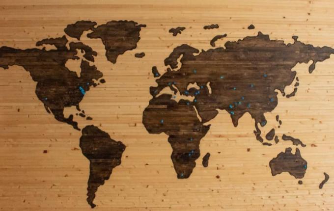
- Shows and describes various forms of the earth's surface (for example, the shape of continents, rivers, mountains) so that the dimensions can appear on the map,
- You can observe various forms of continents in the world on a map.
- Various forms of the earth's surface can be observed from the color symbols that appear different.
- Presenting data related to the potential in an area, for example:
- Drought potential map.
- Map of potential flood prone.
- Fish Potential Map.
- Water Potential Map.
- Shows the size, because through a map it can be measured the area and various distances above the earth's surface. The actual distance for 2 locations can be calculated by comparing the scale on the map.
Purpose of Mapmaking

The following are some of the objectives in making maps that you need to know, including:
- Helping a job, for example in terms of making irrigation canals, roads, and navigation.
- Store at once to communicate spatial or spatial information.
- Help for spatial data analysis, for example in calculating the volume of water discharge, and others.
- Assist in making an area design, for example in the planning of residential complexes, green lines, and commercial complexes.
Map Terms

The following are some of the requirements for making a good and correct map, including:
1. Equidistant
Equdistant is a map projection that will maintain the length scale along a line or more.
Which means, a good map will maintain the distance in the original state on earth with the distance drawn on the map.
Advertisement
Example:
The distance from city A to city B is 40 kilometers in the original state. So, the map will later depict the same distance but in a smaller scale form.
2. Equivalent
Equivalent is a map projection that maintains the area of an area.
Which means, a map that depicts an area using the same area as the original state.
A map that depicts the original area of an area using a scale.
3. conform
Conform is a map projection where at the intersection angle there are two lines or curves that do not change.
Which means, on a good map can maintain various angles and the shape of an original area depicted on the map.
4. Complete information
As we all know that maps are made to provide information to the readers.
Therefore, a good map is a map that contains complete information.
A map that has complete information must have several components such as the following:
a. Map Title
A good map requirement is to have a map title.
The title of the map will help you understand the contents of the map.
For example, the title of the map on the world map, the map of irrigation canals in sub-district A, the map of Jakarta, the map of the distribution of rare plants B, or others.
b. Map Scale
Map scale is the most important map component.
Where on this scale will show a comparison between the map and the actual situation on the earth's surface.
Basically a map is a picture of the earth's surface that is reduced many times. But still maintain the distance, angle, area, and original form.
So that the inclusion of the scale on the map will help to determine the original state of the area depicted on the map.
c. Directions
Directions or direction orientation on a map will show the position of the area in the cardinal points.
With these directions, you can find out the west, north, south, and east directions from the map.
d. Symbols and Colors
Maps have symbols and colors that will provide information for existing features.
For example, for various types of lines that are used to represent roads and area boundaries.
Small black box to depict a building.
The curved line in blue will depict the river.
The black triangles represent mountains, and the red triangles represent volcanoes.
For more information regarding symbols and colors on the map, please visit the following page: Map Component.
e. Legend
The legend inside is an explanation of the symbols and colors used on the map.
f. Source and Year of Manufacture
The source and year of manufacture of the map also need to be included so that readers can know whether the map is accurate.
Because, the earth's surface will change over time either due to natural factors or human activities.
g. inset
An inset is an image outside the mapped area.
For example, you will describe a map of Indonesia, so at the ends of Indonesia it is necessary to draw the boundaries of the surrounding area.
Examples include the Indian Ocean, the Pacific Ocean, Papua New Guinea, Malaysia, and the South China Sea.
The inset will later provide information on the position of an area from another area.
By using the inset, you will know where the area depicted on the map is located.
5. Easy to Read
The last requirement for making a good map is easy to read.
All information contained in the map must be printed clearly so that it will be easy to read and not cause misperceptions from the reader.
X CLOSE
Advertisements
X CLOSE
Advertisements
